01 Dec 2016
Discover the delights of cycling in Leeds through a new interactive cycle map for West Yorkshire
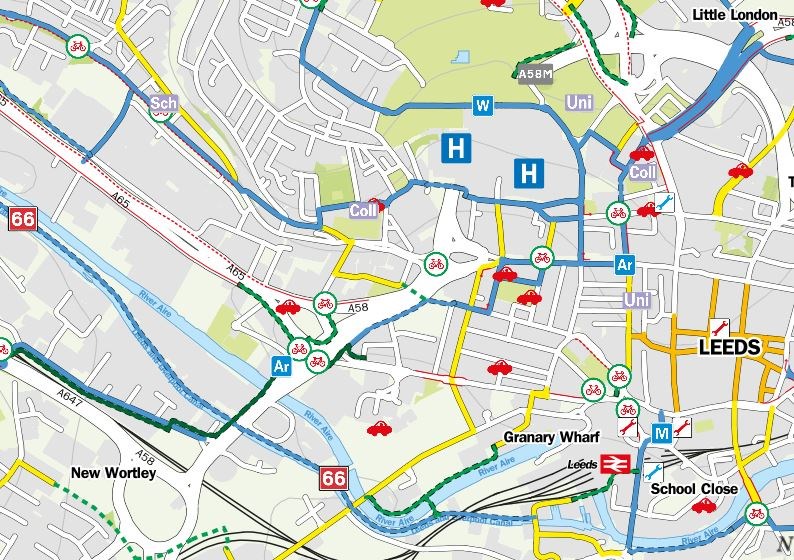
A fantastic new digital on-line map offering a wealth of information to keen and would be cyclists in Leeds and West Yorkshire has been launched.
Developed in partnership with four other local councils’ and the West Yorkshire Combined Authorities’ City Connect team, the West Yorkshire Digital Cycle Map provides cyclists with details of cycle routes, tracks and paths in Leeds and in towns and cities right across the district. Other local authorities to feature in the project are Bradford, Kirklees, Calderdale and Wakefield.
Through the interactive map, cyclists can plan their journey seamlessly across the district boundaries and ride across Leeds and West Yorkshire with confidence. Not only does the map allow for users to zoom in and find out where the best on-road and off-road routes are in Leeds, they can also discover the finest leisure rides, where to find bike parking, and even where local bike shops are situated.
Additional features on offer in the Leeds map include; embedded web links to schools, cycle shops and community bike hubs websites, the location of cycle parking in the city centre, car club locations to help integrated transport and Toucan style bicycle crossing points.
The newly opened City Connect Cycle Superhighway between Crossgates, Leeds city centre and Bradford also features on the map, with a journey planner available to plot point to point routes to give the quickest or quietest ways.
Anyone wishing to view the West Yorkshire Digital Cycle Map can do so through a link on Leeds City Council’s cycling pages at: http://www.leeds.gov.uk/residents/Pages/Cycling-in-Leeds.aspx or directly at https://fourpointmapping.sustrans.org.uk/westyorkshirecyclemap/westyorkshire.html
The link to the Cycle Streets Journey Planner can be found bottom centre-left of the map.
Councillor Richard Lewis, Leeds City Council’s executive member for regeneration, transport and planning, said:
“I am delighted to see the introduction of the West Yorkshire Digital Cycle Map, which will provide people who love to get on their bikes with an excellent resource to tailor their rides not just in Leeds, but right across the district.
“Through the map, comprehensive coverage of West Yorkshire bicycle routes and facilities is made available for the first time, which is great news, while from a Leeds perspective, we have also added a few extras such as web links to cycle shops and community bike hubs to further enhance the user experience.
“We are undertaking a range of work to deliver on our Le Grand Départ 2014 legacy, and projects such as this one are important tools in opening up to a wider audience what we have to offer in cycling in Leeds.”
For media enquiries, please contact;
Colin Dickinson, Leeds City Council press office (0113) 39 51578
Email: colin.dickinson@leeds.gov.uk
For media enquiries contact:
Leeds City Council Communications team
communicationsteam@leeds.gov.uk